Saturday, January 25, 2014

Alligator Point, Florida

The natural beauty of Phipps Preserve
can leave one at a loss of adjectives
My childhood memories of Alligator Point, Florida, are lengthy and fun-filled.  Located just off Highway 98, the coastal highway hugging the West coast of Florida, the peninsula got its name from its 'footprint' on the map, stretching out like an alligator.  My family has been coming to Alligator Point for years due to its close proximity to our hometown.  Some live on the Point year-round and others come for weekend respites escaping the hectic workweek in the nearby capital city of Tallahassee.  Only 200 yards wide in some spots, many homes are built on stilts to survive the occasional hurricane that comes near.  Hurricane Agnes caused the most destruction at Alligator Point.  On June 19, 1972, the hurricane, which originated on the Yukatan Peninsula, made a direct hit on nearby Panama City and destroyed a number of homes built flat on the sand.  
One of the appealing aspects of this destination is the slow pace of life.  Traffic is non-existent as are shops and stores.  It's a five mile trip back to Ochlocknee Bay for groceries.  

At the western end of the Point stands a chain link fence warning visitors of No Trespassing.  This begins Phipps Preserve, named after its benefactor, John S. Phipps, who donated the land at the urging of islander, Dr. Charlie Watt.  One interesting aspect of the preserve is that it is actually a growing land mass.
Years ago this post marked the end of Alligator Point's
western tip.  Sand has built up through the years
adding hundreds of yards to where Gulf used to be
Navigation posts for fisherman which used to mark the tip of the Point are now hundreds of yards back as nature has seen fit to add fresh deposits of sand to this spectacular scenic wonder.  Thus, reachable only by boat.


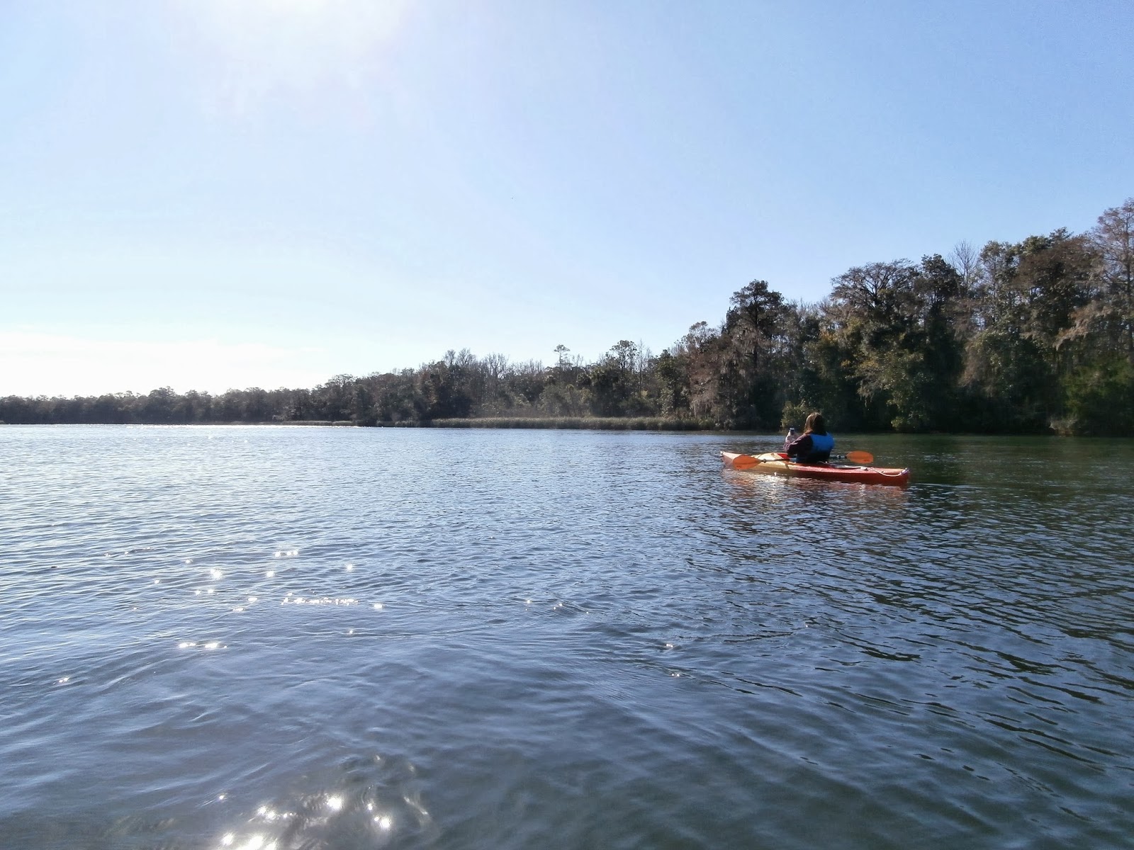
To see a You Tube video of the trip, click on the following link Alligator Point Kayaking

Ichetucknee River

Heading upstream toward a beautiful rock outcropping.
Not far off of the bustling Interstate 75 near Gainesville, Florida, flows a spring-fed unspoiled pristine river called the Ichetucknee, an Indian word meaning, 'pond of the beaver.'  What makes it great?  Almost the entire six mile span of the river is 20 feet wide, five feet deep.  It is hard to fathom that in this day and time, the water can be so clean and pure.  As often happens, a friend needed picking up in Gainesville on a Sunday afternoon and immediately my, "How can I work a kayak trip into this," brain started planning.  For me, getting there is half the fun as we located County Road 238 on the map near the town of Fort White.  During the summer, the Ichetucknee Springs State Park offers put-in and pull-out points for inner-tubes.  But we were there in January, on a chamber of commerce day with blue skies, no wind and 65 degree temperatures.  We only encountered four other kayaks and canoes...it was perfect.
This little fella had a great vantage
point right in the middle of the river.
They grow the turtles big on the Ichetucknee and they are plentiful along the river sunning themselves on logs, often five and six crowding on.  As is our custom, we paddled upstream to our turnaround point.  It was a fairly effort and only one or two spots did we need to 'thread the needle' to get through a fallen tree that had not been cleared.  Once we turned around and paddle just a little, our kayaks moved quickly.  All too soon we made it back to starting point and pulled out.  My wife and I agreed that the Ichetucknee has made it near the top of our favorites list.

Saturday, December 14, 2013

The Aucilla River

Our put-in point at the South Salt Street bridge.  It was a narrow,
rocky walk down to the water carrying the kayaks...but well worth it!
I first became intrigued by the Aucilla River when, as a boy, I would fish a friend's pond in Boston, Georgia, where the Aucilla (Creek at that point) ran through it.  The fishing was really good back then as I remember anchoring our boat at the mouth of the creek and using crickets as bait, we would pull in red belly bream one after another.  Years later longtime family friend R.C. Balfour wrote a book titled, 'In Search of the Aucilla.'  It traces the origins of the river in Thomas County and traces its flow down to the Gulf of Mexico.  A few weeks ago, I talked a pilot friend into taking me up in his plane to scout the river in the Monticello, Florida, area.  Once up in the air, we would plainly see the path of the river and its surrounding vegetation as it wound its way to the Gulf.  After scouting the area out on Google Maps, we headed for Lamont, Florida, to put in next to the bridge on Highway 27.  Much to my disappointment, the road to put in there was much narrower and not conducive to pulling a kayak trailer down into.  We retraced our steps back into Lamont and with the help of our smart phones we followed South Salt Street out 7.6 miles to a bridge with a decent dirt path to get the kayaks near the water.  Once offloaded, we had to carry each kayak down a narrow, rocky path down a steep bank into the water.
The effort was worth it.  With the sunlight racing for the horizon we had to make good use of our time and paddle quickly up stream.  We were rewarded with my favorite kind of water...no ripples and smooth as glass.  At this point the river has a good number of turns to keep things interesting and we went as far as a set of shallow rapids that kept us from going further.  Turning around, we headed downstream and marveled at the high banks lined in areas with beautiful palm trees.  The water level was obviously down this day as this area is in need of rain.

Late afternoon in December on the Aucilla River near Lamont, Florida


There were times on our journey that we stop paddling and just listen to the perfect peace and quiet.  That's something that is rare for us to hear these days, but we found it that day!  I can now understand Mr. Balfour's love of the Aucilla.  We plan to traverse it closer to the Gulf in the future, but nature lovers would do well to make the journey to this semi-remote area of north Florida for a getaway.  To view a brief video of the Aucilla River trip, click on the following link http://youtu.be/NK1y7t5giq8
The Vitals
Gas:  Get it in Lamont, FL, if you are low.  One convenience store in the middle of town on Highway 19.
Food:  See above
GPS Location:
  30.273267,-83.856837

Saturday, November 30, 2013

Moultrie Bike Trail A Winner

The Tom White Linear Bike Trail is well marked
with posts and stripes at each mile.
Trains once crossed the south in the late 1800s with many tracks becoming inactive as  Eisenhower's Interstate highways began growing the trucking industry in the 1950s.  With track lying dormant, visionaries began to realize that converting the tracks to bike trails was a relatively easy proposition.  Moultrie, Georgia, had such visionaries who converted an old CSX rail bed into a 7.2 mile long path officially called the Tom White Linear Park.  After eating my bike's weight in food Thanksgiving Day, I loaded up my bike and headed up Highway 319 North to the Moultrie Airport which is at the southern end of the trail and where parking is plentiful and easy access to trail is found.  The trail is flat for most of the way with only gradual grades in spots.  The trail features a good amount of fresh asphalt and is wide enough for bikers and walkers to share the space.
Ample parking is available near
the halfway mark of the trail.

Beginning at the airport the trail offers riders a full canopy of foliage for the several miles as it parallels both the airport runway on one side and Highway 319 on the other.  One key crossing of the highway is necessary to continue the route toward downtown Moultrie.  Moving toward town offers vistas of Sunset Country Club's 18-hole golf course, while at the five mile mark a large parking lot is a featured spot for those would rather park there and venture out on a short route in either direction.  One reward of making it all the way to its northern terminus at West Central Avenue and 1st Street NW, is downtown Moultrie is just a few easy blocks away...(hint...FOOD!).  I can personally recommend The Blue Sky Grill for a delicious meal with local flavor.  

I especially recommend this trail for families as the route can split up into two separate sections which takes crossing Highway 319 out of the picture.  One of my favorite parts of starting at the airport is the great FBO by the Allan Mathis family.  Clean, friendly and always ready with a smile, it's just a pleasure to begin there.
The Vitals

Gas:  Available at entry points all along the route.
Food:  Convenience stores dot the route as well restaurants downtown near the northern terminus of the trail.

GPS Coordinates:  31.086642,-83.808332
 

Daddy-Daughter Adventure Time

Elizabeth moving down the Wakulla toward St. Marks
We could have gone to see a movie together, but that's an indoor activity and we like to be outside...so when my oldest daughter was home from college for the Thanksgiving break, it didn't take much to talk her into taking the kayaks down to the Wakulla River to navigate a portion of the river I had yet to do and really could only do with someone driving my 4Runner with the kayak trailer to our terminus at the St. Marks landing.  My wife graciously agreed to be our driver and we were set.  I intentionally took us to our put-in point at intersection of the Wakulla River and Highway 98.  For the $5 fee, you get a nice clean and convenient spot to put-in.  A cloudlees morning greeted us and a nice Fall temperature of 55 degrees as we pushed off and headed downstream.  I immediately began scanning the waters for manatees.  The water was clear and the bottom only 3-4 feet deep in places, but no sign of the manatees. 
Beautiful cypress tree adorning the Wakulla River
In a matter of 300 yards the river widens significantly and we just couldn't find them.  The sun shown brightly in our eyes and the wind picked up as we moved along.  With a flannel shirt on top of another long-sleeve shirt and a life-vest on top of that, it didn't take long for her to heat up enough that we had a make a mid-river stop to remove the flannel. 
For such a beautiful morning I was surprised that it took 45 minutes until we saw our first boat.  Unadvisedly, I cautioned Elizabeth that if we saw an alligator that she should just keep paddling forward as the gator was as afraid of us as we were of it.  That advice wasn't received too well and I was advised not to tell her younger sister the same thing should she ever honor me with a trip together.  We passed several make-shift marinas and came to the junction of the Wakulla and St. Marks Rivers.  The fishing must have been great in this area as a number of boats were gathered there working it over.  We hugged the shoreline and coasted up to the landing.  And just like a pro she is out of her boat, on dry land and pulling the kayak up the hill to complete the trip.  It took us exactly one hour.  She confessed halfway along the route that she was getting sore, but when it was all said and done-no problem.  So this one is in the books.  Great photos and great memories of our first kayaking trip together.

Saturday, November 23, 2013

Banks Lake

Scenic Banks Lake's still water reflects the
numerous cypress trees.
Banks Lake National Wildlife Refuge is located just a few miles east of Interstate 75 in Lakeland, Georgia, and just off the end of a runway of Moody Air Force Base.  The beautiful cypress lake provides 900 acres of open water to explore by boat.  The Burt Reynolds movie, Gator, was filmed here in 1976.  We put the kayaks in at the Banks Lake Outpost store/landing and headed out.  I had been warned by a number of my boating friends that the lake was loaded with alligators (I knew not to tell my wife or I would be making the trip alone!). 
Cypress trees changing color in the Fall
This late-November day had the tops of the cypress trees a beautiful color of orange and red.  The trees are loaded with Spanish Moss that hangs so gracefully from its limbs.

Back to the alligators...we only saw two the entire time.  The first one, however, was substantial.  As we watched him drop out of site, all of a sudden our kayaks began to move much quicker.  Interesting how that works.  Our most enjoyable time was spent weaving in and out of the clusters of trees.  The water was quieter there and the noise from nearby Highway 122 was dimmed as well.  This allowed us to easily spot our second gator who slowly departed our area...and stopped...and dropped.  You guessed it, time for the move your kayak fast drill.
Sunrise is a spectacular time at Banks Lake
Banks Lake has a 1/2 mile walking trail, boardwalk and observation platform are great areas to observe osprey, bald eagle, wood storks, red-shouldered hawks and wading birds.  Large numbers of sandhill cranes visit the refuge during the winter months.

The Vitals
Gas:  Available 1 mile east in Lakeland or several miles away in Hahira, GA.
Food:  Mom & Pop stores close by or Valdosta is 15 miles to the south.
GPS Coordinates:  31.035241,-83.096634

Sunday, November 17, 2013

Reed-Bingham State Park

The early morning offered a pool of water
as slick as glass...this paddler's favorite!
She didn't really want to get up that early on a Saturday morning, but she obliged and it was worth it.  My wife and I travelled the short distance from our house to Reed-Bingham State Park, located about nine miles east of Moultrie, Georgia.  Getting there takes you off the Moultrie bypass and onto a typical south Georgia country road with fields of cotton and beautiful pine forests.  Parking at the 375 acre lake is plentiful with good, clean rest rooms handy.  A nice ramp is available to launch from and then it's time to head upstream of the Little River.  The river is popular with fisherman and it is easily shared with kayakers.  The winding turns in the river offer an ever-changing scenery.  We only spotted one alligator on our outing which is just enough for my wife...well, maybe one too many!  We could have gone farther up than we did, but we ran out of time and had to head back.  We'll go back again as it is just too close and too easy to get to.

The Vitals
Gas:  Available in nearby Moultrie or several miles east in Adel.
Food:  Bring your own or try Carter's Catfish House near Adel.
GPS Coordinates:  31.167337,-83.547572

Saturday, November 16, 2013

Flint River

On a beautiful Fall morning, before the football games started, my wife and I set out for the Flint River at the Newton, Georgia, landing at the end of River Trace Road.  Located nine easy miles from Camilla, Georgia, we used a nice, quiet public landing with very little activity.  The area was formerly inhabited by Creek and Muskogee Indians and artifacts have been found up and down the river through the years.  A wide concrete ramp takes you down to the water's edge.  The current here is modest and the river is wider than I anticipated after scouting it out on Google Maps.  The water is very clean and only an occasional Fall leaf floating gently past.  Gorgeous trees turning from green to shades of gold and orange lined the river.  We encountered only one other boat during our 1 1/2 trip up and back.  The reward of paddling against the current was a rather swift return to the landing.  For our spectator sport, we watched turtles on logs scurry into the water as we approached.  This trip presented a great workout for our shoulders and upper body and the scenery was breathtaking almost the entire way.

The Vitals
Gas:  Camilla - 9 miles East
Food:  A number of fast-food restaurants are located on U.S. Highway 19 in Camilla.  For local flavor, The Bistro, right downtown, is a delight.
GPS Coordinates:  31.308849,-84.334933

Only One Earth. Let's Recycle!

Recyclable box in my office where I work.
OK.  I know right away you can spot one of my weaknesses in the picture to the left...Diet Pepsi.  But let's focus on my message here...we only have one earth and we all need to recycle whenever we can.  My city has a recycling program which consists of two drop-off locations in town which take plastic, aluminum cans, newspaper, magazines and cardboard.  Additionally, they offer commercial pick-up of containers each week.  At home, I keep a tall kitchen trash can in our laundry room to hold recycled items during the week and outside behind our house is a large trash can with a lid that I transfer the items into on the weekends.  Eventually, that one gets taken to the recycling center closest to our house.  Several years ago I asked our city sanitation department if they could leave a recycling bin where I work.  My co-workers caught on we now have three bins there that the city picks up weekly.  The box in the photo above sits in my office and I fill it and over time will then empty the contents into the recycling bins outside.  I get a really great feeling when I drop items into a recycling bin.  I'm know I am doing my part and again, hope I am setting a good example for my kids.  So much unnecessary waste is going into our landfills that could be recycled with just a little bit of effort.  I've tried to describe my simple method for recycling.  You can figure out a plan that will work for you, but I hope you will join me in doing our part to protect our resources.  Think of your kids, grandkids and the future that is before them.  This is one thing you definitely have the power to impact.

St. Marks River

View from my kayak heading up the
St. Marks River late on a Fall afternoon.
The St. Marks River is a real scenic gem.  Located 20 miles from Tallahassee, Florida, it is the terminus of the old St. Marks railroad and was originally known as San Marcos de Apalache, this town was founded by the Spanish in the 17th century.  Now the quiet town is home to a large marina and several seafood restaurants.  The rail line has been turned into a magnificent rail-to-trail for bicyclers.  The St. Marks Trail is 16 miles long and begins at the edge of the truck route around Tallahassee and ends 50 feet from the rivers' edge.  A nice public boat ramp is adjacent to the ruins of the San Marcos fort.  Putting the kayaks in is easy there as there are two concrete ramps.  The ramps are located at a point where the St. Marks River meets the Wakulla River.  The river is scenic no matter where you are.   One of the funnier things that happened on the trip was mullet that would jump out ahead of our kayaks.  Some were getting two feet of air and they just seemed so happy!  We would chuckle as one would jump here, flap around and splash and another would jump over here repeating the motion.  Near our turnaround point, we quit paddling, sat still and just listened...to nothing!  It was the quietest moment I have had in years as not a single sound could be heard.  I won't soon forget that.  Boaters have options of going up river, around the corner and up the Wakulla River or out the St. Marks River and into the Gulf of Mexico.  We were there on a warm early November afternoon and were inundated by 'No-see-ums.'  Basically, we were there afternoon snack.  In case you have never encountered them, they nearly invisible flies that have teeth the size of shark teeth and just as sharp!  According to a salty friend of mine, it all depends on which way the wind is blowing as to whether the no-see-ums make landfall or not.  The reward for surviving them is a delicious meal at one of the local seafood restaurants.  We enjoyed a delicious meal on the river at Riverside Restaurant just as the sun was setting.
The Vitals
Gas:  Convenience stores 2 miles from St. Marks
Food:  Several restaurants in St. Marks.  Tallahassee 20 miles north.
GPS Coordinates:  30.151499,-84.209872

Heading back to the ramp at dusk.

Controlling Litter

A garbage bag full of litter picked up on my street.
As written in the description of my blog, I am very interested in the conservation of nature.  I am so fortunate, in my opinion, to live in south Georgia on my property which covers a whopping .83 of an acre.  We do have woods on two sides of our property, great neighbors on another and the view out our front door is a beautiful one of a 40 acre pasture and pond...all just 3/4 mile from a Wendys!  As long as I can remember, I have always been troubled by litter.  I have never been able to figure out why someone would throw trash out of their vehicle.  It is irresponsible and someone who does this is just plain selfish.  I'll get off of my soapbox now and tell you that I try to pick up litter on our street four or five times a year.  In between that, we are fortunate to have trustees from our county prison come through and pick it up.  On a recent litter patrol I filled a garbage bag with a variety of litter.  I don't think I'll ever be able to convince someone who litters to not do it, but I like to think I am setting a good example for my wife, daughters and those who ride by while I am walking the ditches with the bag and reacher in my hand.

Spring Creek

My paddling partner pausing in the
afternoon sunlight to...check text messages.
Located just 9 miles west of Bainbridge, Georgia, on Highway 84 in the tiny settlement of Brinson, sits one of the clearest bodies of water left anywhere south of Macon.  Spring Creek is a delight to navigate.  We put kayaks in at a public landing just below the bridge where there is plenty of parking and space to maneuver your trailer.  The current is pretty swift at the landing, so I recommend going upstream first and then coming back downstream.  The creek is consistently about 40 feet wide.  The water, although not crystal clear, it is clear enough to see the bottom.  The day we ventured there, the water appeared to be six feet below normal level as we eyeballed the waterline on the banks.  The lower water level caused submerged obstacles to be a factor during some of our trip, but we kept a sharp eye out and steered clear of them safely.  The trees above us formed a beautiful canopy and shaded us from the sun allowing streaks of light to flow through in breaks along the way.
The clear waters of Spring Creek provided
an often breathtaking afternoon trip.
The Vitals
Gas:  9 miles away in Bainbridge.
Food:  Plenty of options in Bainbridge.
GPS Coordinates:  30.975615,-84.745496

Sunday, November 10, 2013

Shell Island


Shell Island (near Panama City Beach, Florida)
A trip over to Shell Island had been on my list of things to do for quite some time.  My family often spends time at Bay Point in Panama City Beach, Florida, and from one particular spit of land, one can see Shell Island across St. Andrews Bay.  Shell Island is a 7 mile long barrier island popular for eco-tourists and those who want to spend time in a quieter beach setting.  A convenient launching point for kayaks is at the terminus of Jan Cooley Drive which runs right through the middle of the Bay Point resort.  There is parking for about 8-10 vehicles at this entry point.  Now crossing the bay is akin to crossing Interstate 75 in Atlanta at rush hour as boats are either leaving the marinas and heading out to the Saint Andrews shipping channel (more commonly as "the pass" or "the cut") or coming back in from the Gulf of Mexico.  Mix in a few wave-runners and the waterway can be crowded.  You have to anticipate the gap in the boats and go after it.  The wake created by the big fishing boats will rock and challenge you if you are paddling a kayak, so it is not a trip for beginners or those who are not strong paddlers.  Additionally, the current in the cut is strong and you need to pick out a point on Shell Island and paddle to the point or you will end up a considerable distance from where you wanted to land.  The reward, however, is well worth it.  The unspoiled beauty is refreshing as you have left the hustle and bustle of a resort area and journeyed a mile to a peaceful and scenic spot which amazingly has been respected by visitors and continues in its pristine state.  It's amazing what a barefoot walk along the beach can do for a cluttered mind. 

The Vitals:
Gas:  Seriously?
Food:  BYOF (Bring your own food)
GPS Coordinates:  30.118418,-85.722041 

Sand dunes and pine trees abound on Shell Island

Thursday, October 24, 2013

The Wakulla River

Kayaking is a favorite way to
navigate the Wakulla River

The Wakulla River is located just minutes south of Tallahassee, Florida, and is a real outdoor treasure.  The often clear waters ramble within their tree-lined banks.  This pristine body of water is a favorite destination of kayak, canoe and fishing enthusiasts.  Probably the biggest draw is the chance to see manatees up close...I mean really close!  I had never seen a manatee in person and I must admit, it nearly takes your breath away when your kayak pulls up alongside one...or two!  The Wakulla River is fed by Wakulla Springs which has a beautiful state park complete swimming area, glass-bottomed boat and jungle boat tours.  In fact, in 1941, Tarzan and in 1953, Creature From The Black Lagoon movies were filmed there.  Accessing the river is easily accomplished at a public boat ramp next to the Highway 98 bridge (Cost:  $5) or through a private ramp adjacent where rentals are also available.

Manatees float gently down
the river with the current

Filming Tarzan movie
at Wakulla Springs

The Vitals:
Gas:  Convenience store two miles away.
Food:  The beautiful town of St. Marks (less than 10 minutes away) offers several restaurants.
GPS Coordinates:  30.175923,-84.244977
Address:  6527 Coastal Highway, Crawfordville, FL